#150c Clarkson Covered Bridge

Fleeter Log #150c
Dry Alabama / Wet Mississippi

Day 4 - Sunday
October 4, 2009
295 miles


View Larger Map
Cullman, Alabama to Greenville, Mississippi


It's not a matter of IF we will get wet today, but WHEN we will meet the wall of rain making its way east as me make our way west.  There will be no way to miss it. All of Mississippi is covered by a dark rain cloud. We are routed right through the middle of Mississippi. Make sure the extra waterproof gloves are packed on top and easily accessible.

But before we go into wet mode, we see an opportunity to get a little flower sniffin' in.  A sign for a covered bridge is one of the leading reasons I am found eagerly leaving my route looking for the odd, the old, or anything worthy of of photo-op. Here on CR1043 in Cullman County, Alabama we find the 270 foot long Clarkson Covered Bridge.


Clarkson Covered Bridge in Cullman County Alabama

Down below the bridge is a shady park setting complete with picnic tables.

 Connecting the Dogtrot Log Cabin and the Grist Mill is a wooden walk along Crooked Creek with a close-up view of the spillway.


We managed to make it through Fayette before meeting the wall of rain making its way slowly across Mississippi.

All of our time in Mississippi was spent riding through heavy rain. No more flower sniffin'.  Now the goal is to just arrive safely on the other side of the state where we have a reservation waiting on the banks of the Mississippi River.
When we hit the heavy rain, we made an extra effort to pull zippers all the way up, snap up tight, and keep the chin down low. Less moving around in the gear lessens the chances for the water to find a way in past the gear. But no matter the effort ... water eventually started making it's way past the waterproof gear. First my hands were wet, then I felt the water running up my arm to my elbow. Then one too many blindspot checks and the twisting of my neck allowed a trickle of water to enter. My gear was no longer a barrier to the rain.

While the bikes sat dripping water under the portico of the Comfort Inn, I sloshed my way into the lobby feeling bad for leaving a huge puddle of water with each step I took as I made my way to the clerk's counter.  
 I had tried to drip as much excess wetness as I could while outside with the bikes, but I had absorbed too much water as I made my way across the state. My gear was like a sponge...saturated and heavy. Signing the registration slip without leaving a water puddle on the counter was a wasted effort. There was no avoiding it, I was like Neptune coming up from the deep and entering the dry comfort of the terra firma dwellers.

 Copyright 2009 Fleeter Logs

#150b Catfish & Friends

Fleeter Log #150b
Catfish & Friends


Day 3 - Saturday
October 3, 2009
311 miles

View Larger Map
Clinton, TN to Cullman, AL

Today I have a lunch date near Chattanooga with a few dozen friends from across the country.

This sort of gathering happens when someone get motivated to call a RTE (Ride To Eat) and this time someone was in the mood for catfish.

You never know what kind of little gems one might come across when wandering the back roads. This morning for my unexpected treat, I spotted these classic old cars in a showroom as I rode through Harriman, Tennessee.


  Train Depots are always a reason to stop for a photo op.
Spring City, Tennessee Depot

Coming into Chattanooga, I was running just early enough that I squeezed in a quick side trip down to Alabama to the Russell Cave National Monument before Catfish.

Russell Cave National Monument near Bridgeport, Alabama


After my 65 mile sidetrip to Russell Cave, I made it back to the Riverside Catfish House on the banks of the Tennessee River. A few folks were outside kickin' tires when I arrived.

 These are the kind of friends I get to enjoy the company of at these RTEs. These three just happen to be from Illinois (Terry), Georgia (Charles), and Kentucky (Greg).
Terry, Charles, Greg

Mark, me, Russell
 
RTE over. Catfish ate, friends scattering back to which they came ... or whatever direction the road calls them from here. I ready myself to load up and head back into Alabama ... a bit deeper this time.

One last picture with Scott, the guy that called a few friends together to join him for catfish.

Heading into the Deep South .... Alabama.

Plans came together just right and I met up with Sylvia in NE Alabama middle of the afternoon. We made it to Cullman, Alabama for the night. Tomorrow we head West.

 Copyright 2009 Fleeter Logs

#150a Cumberland Gap

Fleeter Log #150a
Cumberland Gap
2009 October 1-2


                                   Day 1: Fredericksburg, VA to Wythville,VA
Day 2: Wytheville, VA to Clinton, TN


Super 8 in Wytheville, VA
Day 1 - Thursday
October 1, 2009
258 miles

Later afternoon start gets me to Wytheville for the night.


Tomorrow the fun starts when I get off the freeway and into the Appalachian backroads.


Day 2 - Friday
October 2, 2009
312 miles

See three states in one stop at Cumberland Gap. Of course to see the point where these three states come together, one needs to take the high road up to Pinnacle Mountain for the view. As I ride into town about noon, the fog is only broken up by the heavy rain bursts.
After checking in at the visitor center, I decide to head out in search of something to eat and hope the fog clears.
Cumberland Gap National Historical Park


Downtown Cumberland isn't a very big place ... population: 204 people. But, it is big enough to have a great place to eat.

Webb's Country Kitchen in Cumberland Gap, Tennessee

Sue Webb, owner of Webb's Country Kitchen


Hoping the low fog would clear out by the afternoon, I headed up Pinnacle Rd into the unknown to see what I could find.

Pinnacle Road starts out easy enough as it heads up Pinnacle Mountain.

Twisting and turning up the Cumberland Mountains as I climb higher, I hope  to be rewarded with a view of three states --Virginia, Tennessee, Kentucky-- from Pinnacle Overlook at the top.
The fog thickens into a fog soup the higher I climb. Not looking very hopeful for distant viewing from the top.

When I reach the parking lot at the top, the fog is so thick that I can't even see the top of the trees.

Knowing that my chances of a great distant view are shot, I walk the short hike to the overlook anyway. Rather than cry about the loss of a distant view, I turn my lens on the unique scenes the misty fog creates along the path. It's like I am walking into an intense dramatic scene of a movie. But there was no full orchestra setting the mood with a soundtrack. Instead it was eerie quiet. No birds chirping ... not even a a breeze to rustle the leaves.

The fog was even thicker at the top. I felt that if I stretched my arm out into the expanse, my hand would disappear into the ether.

No fog filter needed for effect today!


After wandering around in the fog, I eventually left Cumberland Gap and heading south where I found TN9(US25) in the Brush Mountain Gap area.
 I ended the day in Clinton,Tennessee at a nicely updated Red Roof with a Zaxby's next door. Even though much of the day was in and out of rain, it was not a bad day at all. Nope, not at all.

Copyright 2009 Fleeter Logs

#149 Northern Neck

Fleeter Log #149
Northern Neck

2009 Sept 19


View Larger Interactive Map

The Northern Neck may be a peninsula, but it is not The Peninsula. Of the three peninsulas that make up the shoreline between Jamestown and the Potomac, the Northern Neck is, indeed, the northern most. And the Middle Peninsula is actually the middle of the three. The peninsula on the southern end closer to Jamestown is simply The Peninsula. It's apparent by the inconsistency of the names that those with the naming powers weren't interested in coming together in harmonious accord and simply come up with three names that sounded like they might be found on the map next to each other as neighbors. No, they couldn't even agree on using the term Neck or Peninsula. Sounds like how politicians are running the country today ... no clue what harmonious accord might mean or how to incorporate it into the running of the country. No, in politics it's all about winning, not about using common sense to do what's best for the country.
Northern Neck Bottling Company in Montross, Virginia

Westmoreland County Courthouse

Hwy 3 (Kings Hwy) in Montross, Virginia

Mollusk, Virginia

A local Colonial Tavern has been restored and now serves lunch to those wishing to participate in the tavern experience of 1795.
Rices Hotel & Houghletts Tavern

Old Jail of Northumberland County, Virginia
 
Heathsville, Virginia

Riding through the streets of Lancaster, I see an example of how the streets have encroached closer to the old buildings. But even though streets and buildings seem to try to occupy the same place at the same time, neither one quite wins the battle.


Instead, they meet together at the curb.


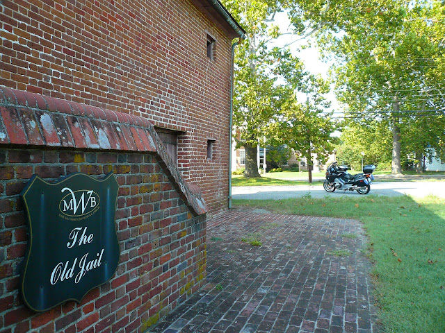
The Old Clerk's Office (circa 1797) has been restored and is home to the Mary Ball Washington Museum & Library.


George Washington's mother, Mary Ball Washington, was born just eight miles from here. Being the mother of the Father of our Country ... Does this make Mary Ball Washington the Grandmother of our Country?

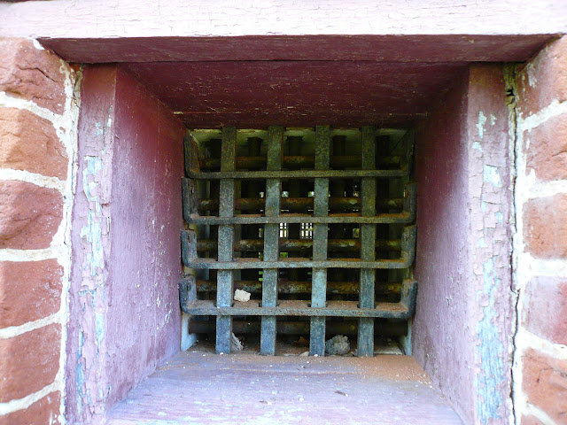
The Old Jail is also a part of the Mary Ball Washington historic site.


Copyright 2009 Fleeter Logs